Hackfall Woods
Swinton with Warthermarske, North YorkshireWalks in North Yorkshire
- Distance
- 1.3 miles
- Time
- 45 min
- Climb
- 298 ft
- Route
- Circular
- Difficulty
- Easy
About this walk
An easy 1.3-mile loop around Swinton with Warthermarske, about 45 minutes.
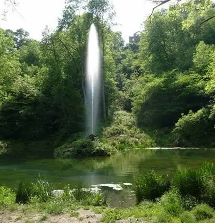
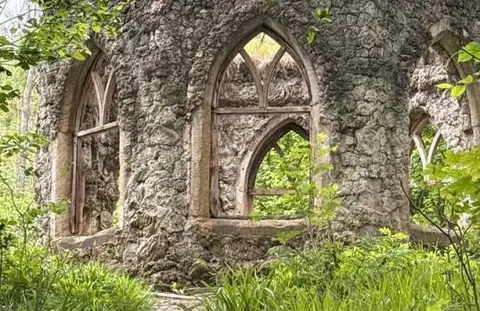
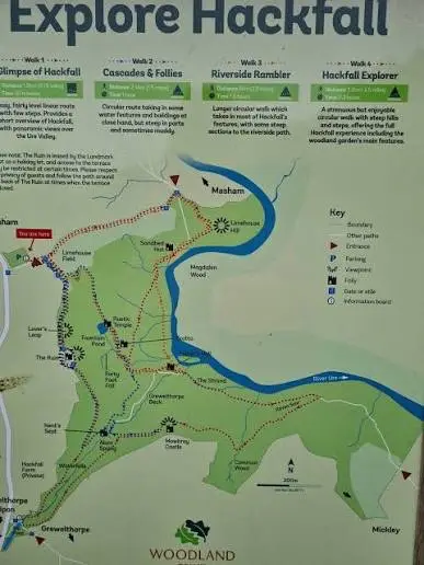
Park in the small on-site car park near Grewelthorpe and Masham — it's limited and fills quickly, so get there early. The walk follows a loop through steep, wooded gorge scenery, with short climbs, tree roots and stone steps underfoot; it gets properly muddy after rain, so wellies or boots are a must. The dog can run mostly off-lead through the woods and get down into the River Ure to cool off, though keep control near the narrow sections where the drops are unguarded. There are old follies and ruins dotted along the way
Near the start
- Stiles
- None mapped on the route
- Woodland
- About 90% of the route
Good to know
- Off-lead time
- Mostly off-lead
- Paths
- Okay
- Mud
- Bit muddy
- Hills
- Some hills
- Busyness
- Moderate
- Parking
- Poor
Photos
More walks near Swinton with Warthermarske

Studley Park
Aldfield · 5.9 miles away
3.8 miles · 1 hr 40 min · Circular
- Circular
- Café or pub nearby
- No stiles

Walk through the centuries at Fountains Abbey
Aldfield · 6 miles away
2.4 miles · 1 hr 5 min · Circular
- Circular
- Café or pub nearby
- No stiles

Fountains Abbey
Aldfield · 6.3 miles away
2.1 miles · 55 min · Circular
- Circular
- Woodland
- Café or pub nearby

Brimham Rocks Boundary Walk
Summerbridge · 8.1 miles away
3.4 miles · 1 hr 30 min · Circular
- Circular
Farmland, Big Skies and Birds of Prey Walk
Summerbridge · 8.6 miles away
4.1 miles · 1 hr 50 min · Circular
- Circular

Swinsty Reservoir
Norwood · 15 miles away
3.4 miles · 1 hr 40 min · Circular
- Circular
- Woodland
- Café or pub nearby
Walk Hackfall Woods with Lead On
Save it to your walks and Lead On will suggest it on a day it suits: the right weather, the right tide and the time you have. It tracks the route as you go, even with your phone locked.