Lindisfarne Nature Trail
Holy Island, NorthumberlandWalks in Northumberland
- Distance
- 3 miles
- Time
- 1 hr 15 min
- Climb
- 74 ft
- Route
- Circular
- Difficulty
- Easy
About this walk
An easy 3-mile loop around Holy Island, about an hour.
Route, mapped by OpenStreetMap contributors.
Near the start
- Dog-friendly café or pub
- Crown & Anchor Inn, 350 m from the start
- Café
- at the start
- Pub
- The Ship Inn, 250 m from the start
- Toilets
- 300 m from the start
- Stiles
- None mapped on the route
Good to know
- Hills
- Flat
Photos

Low tide at Lindisfarne — Photo: Peter Barr, CC BY-SA 2.0 (Wikimedia Commons) 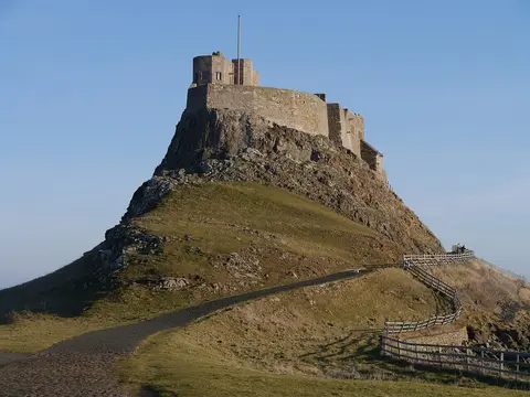
Lindisfarne Castle — Photo: James T M Towill, CC BY-SA 2.0 (Wikimedia Commons) 
Byway running North-South on Holy Island — Photo: Chris Heaton, CC BY-SA 2.0 (Wikimedia Commons)
Walk Lindisfarne Nature Trail with Lead On
Save it to your walks and Lead On will suggest it on a day it suits: the right weather, the right tide and the time you have. It tracks the route as you go, even with your phone locked.