Weybridge to New Haw Lock Walk
Weybridge, SurreyWalks in Surrey
- Distance
- 5.3 miles
- Time
- 2 hr 10 min
- Climb
- 80 ft
- Route
- Circular
- Difficulty
- Moderate
About this walk
A moderate 5.3-mile loop around Weybridge, about two hours.
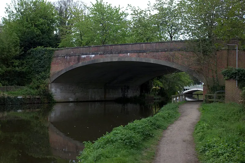
This circular walk from Weybridge heads out to New Haw Lock and back, tracing the waterway used by the final working barges on the Wey. Until the late 1960s, big boats run by Stevens and Sons carried grain all the way from London's Royal Docks to Addlestone's Coxes Mill, and you'll be following their old course. At 5.3 miles with only around 80 ft of climbing, it's rated moderate and takes about 130 minutes. It suits steady walkers who enjoy a bit of local waterway history.
Route waymarked by National Trust, mapped by OpenStreetMap contributors.
Near the start
- Café
- The Ferry Coffee Shop, 450 m from the start
- Pub
- The Old Crown, at the start
- Shop
- Thames Express, 350 m from the start
- Toilets
- 300 m from the start
- Drinking water
- 300 m from the start
- Stiles
- 2 mapped on the route
Good to know
- Hills
- Flat
More walks near Weybridge
Canons and Cornmills
West Byfleet · 4.2 miles away
5.2 miles · 2 hr 10 min · Circular
- Circular
- Café or pub nearby
- No stiles
Egham to Runnymede Countryside Circular Walk
Egham · 5.4 miles away
3.1 miles · 1 hr 20 min · Circular
- Circular
- Café or pub nearby
- No stiles
Bookham Common Activity Trail
Great Bookham · 6.6 miles away
2.2 miles · 55 min · Circular
- Circular
- Woodland
- No stiles

Views Route
Wraysbury · 6.8 miles away
2.1 miles · 55 min · Circular
- Circular
- Woodland
- Café or pub nearby
Chessington Countryside Walk
The Wells · 7.5 miles away
5.2 miles · 2 hr 15 min · Circular
- Circular
- Woodland
- Café or pub nearby
Norbury Park walk (SCC)
Hawk's Hill · 8.5 miles away
2.2 miles · 1 hr 5 min · Circular
- Circular
- Woodland
- No stiles
Walk Weybridge to New Haw Lock Walk with Lead On
Save it to your walks and Lead On will suggest it on a day it suits: the right weather, the right tide and the time you have. It tracks the route as you go, even with your phone locked.